If you’d like to hear about rare Cornish choughs, a cuckoo, stunning wildflowers, breathtaking cliffs, daredevil cows, and the UK’s most photographed beach, join me for a walk from Mullion Cove to Lizard Point on a warm late June day.

As part of our adventures hiking the entire Cornish coastal path, my husband Jamie and I walked this stunning 11km stretch on the south coast. Typically, since the north coast faces the Atlantic, it’s better for surfing, while the south coast, facing the calmer waters of the English Channel, offers sheltered coves and harbours ideal for sailing. Our starting point at Mullion Cove exemplified this.
The lovely morning air greeted us with a gentle, refreshing coolness on our faces. Beyond the cheerful birdsong, a peaceful silence enveloped us; the sea was calm and welcoming, and we set out on our walk while others were still enjoying their breakfast. We stood on the concrete quay in front of the old pilchard cellars, which are now a café, and breathed in the salty sea air.
We knew this section wasn’t as difficult as some of the others we’d walked, and the climb out of Mullion was probably the hardest part of the day. It’s a wide stone-and-earth staircase, and we paused halfway up the cliff to look back and enjoy the classic postcard view of the harbour and Mullion Island with its natural rock arch.

We reached the open heathland at Predannack Cliff, where we spotted an adder. Jamie had previously been bitten on the heel by an adder, so we always stay alert for them. Fortunately, he was fine that day, but we discovered some interesting facts. Most adder bites in the UK are “dry” bites, causing minimal or no venom injection. It seems they are reserving their venom for hunting prey, which is a smart strategy. I’m also learning to recognise different wildflowers, and this walk didn’t disappoint. We quickly saw my favourite, the scarlet pimpernel, and Jamie’s favourite, wild orchids.

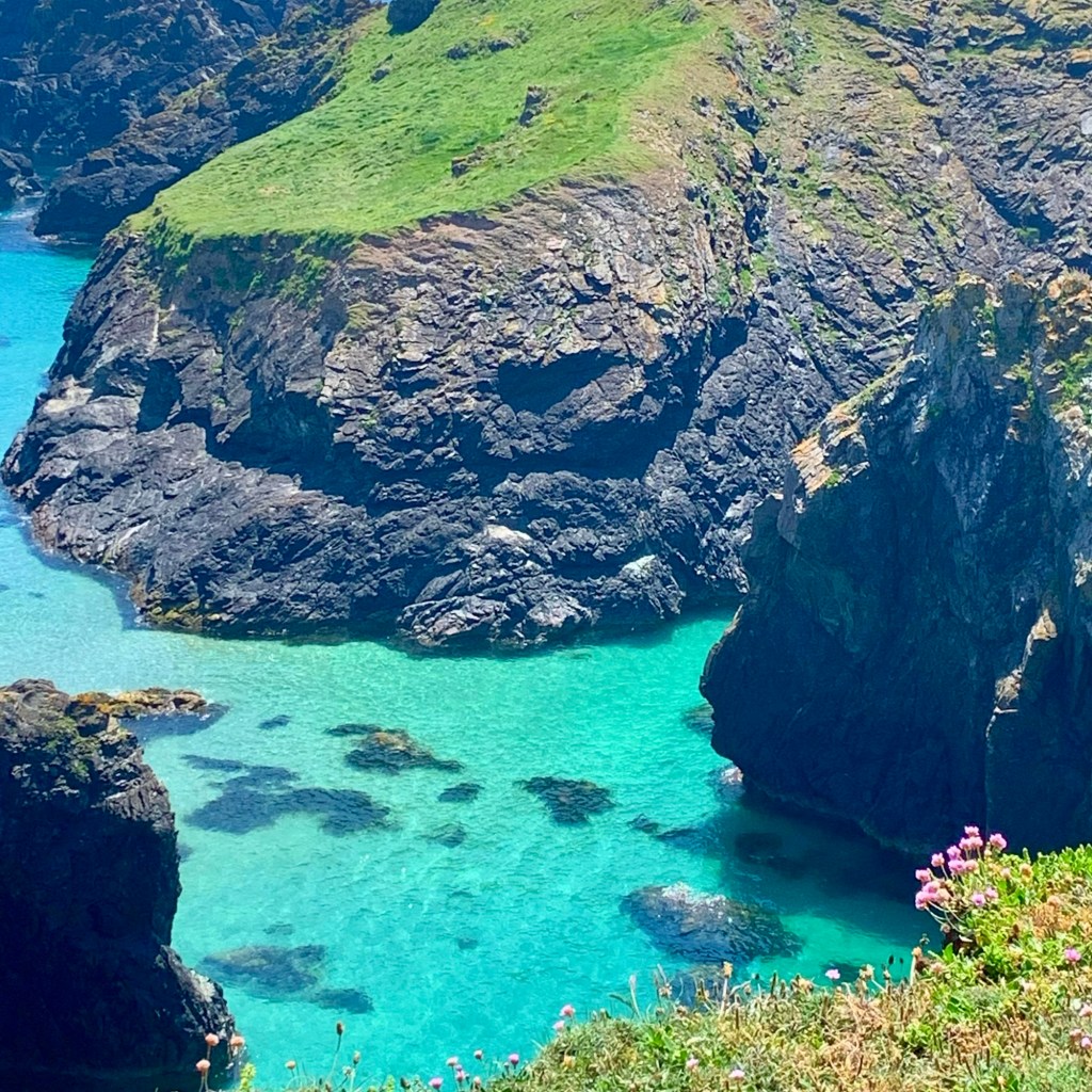
I can’t fully describe the scenery with words, so I hope you enjoy my photos. The sky was mostly clear, and the light was bright but not harsh because the sun was still rising. Below us, the sea reflected the sky almost perfectly, with deep sapphire waters near the shore that gradually lightened into aquamarine as the sand beneath became visible. It was paradise, and we’d only just begun.
After an extended photo stop that was longer than planned, we continued towards Kynance Cove. The trail crosses into National Trust land and the Lizard National Nature Reserve, where we spotted our first Cornish choughs. These birds always bring a smile as they forage through cow dung. They are also an iconic symbol of Cornwall, appearing on our coat of arms and in local legends. Once very rare, their numbers have risen significantly in recent years. We also saw cows, undoubtedly responsible for the dung, living quite literally on the edge – admiring the cliff-top views. This made me feel slightly nervous, but they seemed to know what they were doing.

We found this to be a fairly gentle section, with only one descent that was a bit tricky. We stopped halfway down to listen to a cuckoo. I hadn’t heard a real cuckoo before, and it sounded exactly like hearing a cuckoo clock, just with less predictability. It did make me laugh when I realised that the mechanical, hourly chime you associate with quaint German craftsmanship is a direct, albeit rigid, imitation of a wild bird with no regard for your schedule.
After the cuckoo excitement, the ascent was relatively easy, and once at the top, we followed the coast path along the cliffs to find a nice rock to sit on to enjoy the coffee and biscuits we’d brought with us. It’s tempting to cut straight across the heathland here, but doing so means missing out on the most spectacular views and perfect spots to pause.
We heard a drone overhead; luckily, it wasn’t someone spying on our peace. We were close to Predannack airfield, where the Royal Naval Air Squadron tests its drones to explore their future potential. If you’re fortunate, you might also glimpse an F-35 flying overhead after taking off from nearby Helston.
The day was warming up, and I had remembered my hat. If you’ve read my other blogs, you’ll know that’s not always the case! We headed towards Kynance and couldn’t believe what we saw. The car park was so crowded that even seagulls were circling in frustration, and the beach looked as if it had been sprinkled with people instead of sand.

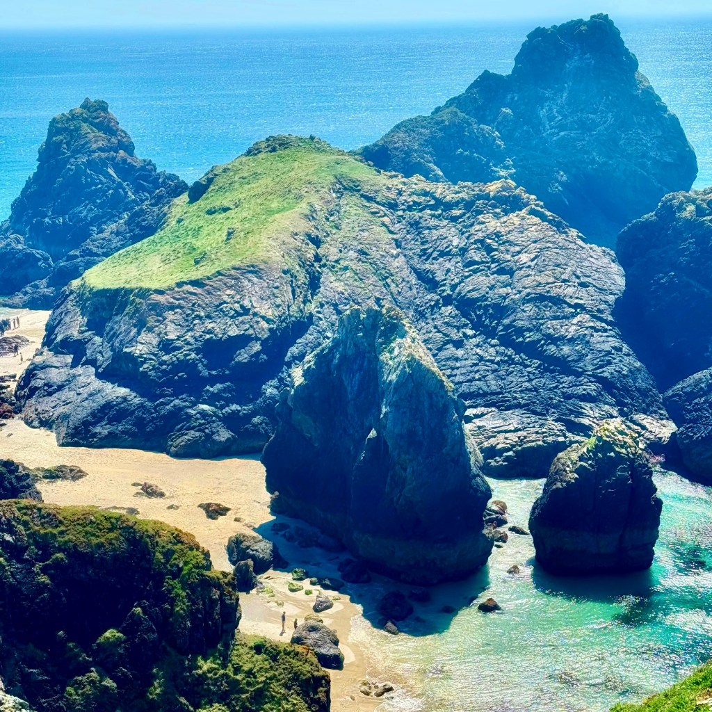

Kynance Cove is one of the most photographed (Instagrammed) beaches in the UK. It looks almost perfect, like a film set. Towering serpentine rock stacks and islands rise straight out of the sand like natural sculptures. At low tide, they form arches and small turquoise lagoons. The sand is nearly white, reminiscent of the Caribbean, and today, in the sunshine, the vivid contrast made it appear oversaturated even in real life. It’s regularly voted one of the world’s most beautiful beaches, and because the cove faces west, it’s a photographer’s favourite at sunset.
Anyway, I diverge, we descended and ascended in record time until we were back up high, looking down on the chaos below.
The path remained high on the cliffs, offering stunning views of Asparagus Island and the stacks below, and we had now decided it was time for our packed lunch. There is a café at Kynance, but as you’ve probably guessed, we decided to give it a miss 😊
After our cheese and tomato sandwiches, we set off and observed the coast path becoming more rugged, with jagged, serpentine rock cliffs showing shades of red, green, and purple. About 20 minutes later, we arrived at a wooden viewing platform overlooking the Devil’s Frying Pan—a collapsed sea cave with a natural rock arch, making it a worthwhile short detour from the main trail. The path gradually descends until we reach the ruins of the old Polpeor lifeboat station, which sits dramatically above a steep slipway leading into the sea. We had visited here once before in winter when the sea was rougher, giving the scene an eerie atmosphere. From this point, we faced a short, steep climb back to the clifftop, where the White Lizard Lighthouse suddenly appeared above us.
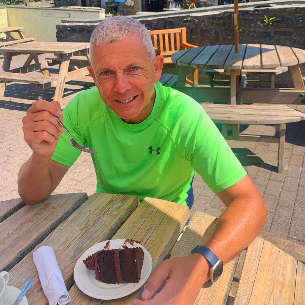
The trail then carried us past the lighthouse, and this is where I conclude my blog, at the southernmost point in Britain, where you can stand without getting wet. The hike is over, the views were unforgettable, and the final life-changing moment was finding a bus back to our car! Oh, and when we finally reached our car, we couldn’t resist stopping at the chocolate factory just outside Mullion for tea and cake!
Until the next hike xxxxx